Unfortunately the prototype prints using cyanotype onto tiles failed in the final hurdle… The images effectively disappeared after last firing. Time limitations mean this technique lacks sufficient time to complete using a trial and error process
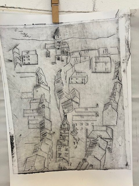
But my research on old maps and the idea of reimagining ancient Dumfries was assisted by a visit to Leiden, the Netherlands.
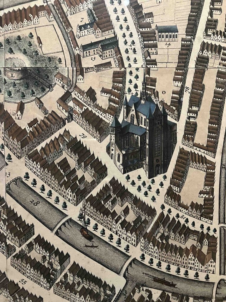
A museum there displays a map dated mid-to- late 17th c. Similar to the old London maps (see e-Portfolio post 08 February), however it depicts buildings and streets in greater detail than the earlier English equivalents.
Below you can also see a seam where plates were put together for a final print.
I have produced a sample of a mock ‘copperplate’ map print depicting Dumfries in 1707: for the finished work I could hand-tint the roofs and green spaces; perhaps hand embelish more details in pen and ink. Then for the small niche have three ”Fragments” of the Lost Map of Ancient Dumfries.